Drone technology has rapidly evolved in recent years, leading to a surge in demand for drone services across various industries.
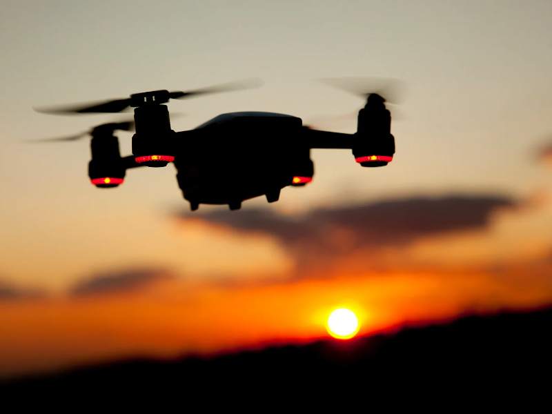
Drone services refer to the multiple applications of drone technology for commercial purposes, such as aerial photography, surveying and mapping, inspection, delivery, and emergency response. The scope of drone services constantly expands, with new applications and use cases emerging daily. The drone services industry is a rapidly growing market, with a projected value of $63.6 billion by 2025. This growth is driven by the numerous benefits of drone technology, such as cost savings, improved efficiency, and enhanced safety.
This article will provide an overview of drone services, their various applications, and their benefits. We will also discuss the regulatory considerations and safety measures that drone operators must adhere to and provide tips for choosing the right drone service provider. Finally, we will explore the future of the drone services industry, including new applications, technological advancements, and potential challenges.
Types of Drone Services
Aerial Photography and Videography
Aerial photography and videography are two of the most common services drone companies offer. Drones equipped with high-quality cameras and lenses are used to capture stunning aerial views that would be difficult or impossible to capture by traditional means. The types of cameras and lenses used in aerial photography and videography depend on the project requirements. For instance, some cameras are better suited for low-light conditions, while others excel at capturing high-resolution images. Similarly, different lenses can achieve various shots, such as wide-angle or telephoto shots, and so on.
In Western Massachusetts, one of the most common use cases for aerial photography and videography is in the real estate industry. Real estate agents and property developers can use drone footage to showcase properties from unique and captivating angles, giving prospective buyers a more immersive and detailed view of the property. Drone real estate photography can also create dynamic promotional videos for events and businesses, such as weddings, concerts, and tourism campaigns.
Other applications of drone photography and videography include advertising, where companies can use drone footage to create captivating ads that showcase their products or services from unique perspectives, such as overhead shots of a car driving through a scenic location, film-making where aerial footage can also be used to capture sweeping landscape shots or to provide viewers with a bird's-eye view of a particular location, and to capture footage of large-scale events, such as music festivals and sports games.
Overall, aerial photography and videography are versatile drone services that offer a range of creative and practical possibilities.
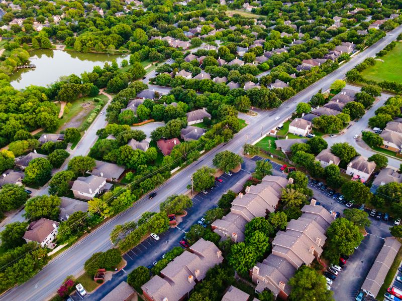
Surveying and Mapping
Drone services are becoming increasingly popular in the field of surveying and mapping thanks to their ability to gather high-quality, accurate data quickly and efficiently. Unlike traditional surveying and mapping methods, drone services offer many benefits, including faster data collection, greater accuracy, and increased safety. Companies can significantly reduce project timelines and costs using drones instead of conventional methods such as ground-based surveying. Additionally, drones can operate in hazardous or hard-to-reach areas, reducing the need for workers to be exposed to potentially dangerous conditions.
Drones equipped with a range of sensors and software gather different data types for surveying and mapping purposes. For example, drones can use photogrammetry to create highly detailed, high-resolution maps and models or LiDAR to measure distances and capture data on vegetation and terrain features.
Drones in construction are often used to survey and map construction sites, helping engineers and architects better understand the topography and contours of the land. By collecting data from multiple angles and altitudes, drones can create highly accurate 3D maps and models, which can be used for site planning, building design, and construction progress tracking. In mining, drones can identify potential mineral deposits, map mine sites, and monitor environmental impacts. Drones with high-resolution cameras and LiDAR sensors can quickly capture detailed data on mine sites, allowing mining companies to improve safety, efficiency, and environmental compliance. Agriculture is another industry that benefits significantly from drone surveying and mapping services. By using drones to survey and map fields, farmers can gain valuable insights into crop health, soil moisture levels, and other environmental factors. This data can be used to optimize crop yields, reduce waste, and minimize environmental impact.
Search and Rescue

Drones are increasingly used in search and rescue operations because they can cover large areas quickly, access hard-to-reach locations, and provide real-time data to rescue operations. They can quickly and efficiently search large areas and provide real-time information to rescue teams, enabling them to locate missing individuals and respond to emergencies more effectively. Using drones in emergencies can save lives and reduce the risks associated with traditional search and rescue methods.
Techniques and Technologies Used:
-
Thermal Imaging: Drones equipped with thermal imaging cameras can detect body heat and help locate missing persons even in the dark or obscured by thick vegetation. Thermal imaging can also identify areas of heat concentration, such as burning buildings, which can aid rescue teams in identifying hotspots or trapped individuals.
-
GPS and Mapping: GPS technology in drones allows rescue teams to track their movements and keep track of areas they have already searched. Mapping capabilities can help visually represent the search area, including landmarks, terrain, and potential hazards, such as rivers or cliffs.
-
Communication: Drones can be equipped with two-way communication systems, allowing rescue teams to speak with missing persons and vice-versa.
-
Drone Delivery: Drones can deliver essential supplies such as food, water, and medical equipment to people in remote or inaccessible locations.
Success Stories and Case Studies:
-
Hurricane Harvey: In 2017, Hurricane Harvey hit the southern United States, causing widespread flooding and damage. Drones were used to assess the damage and locate stranded individuals, and rescue teams were able to save numerous lives thanks to drone-assisted search and rescue efforts.
-
Nepal Earthquake: In 2015, a massive earthquake struck Nepal, causing widespread damage and loss of life. Drones were used to map affected areas, locate survivors, and deliver aid and supplies to hard-to-reach locations.
-
Snowstorm in Utah: In 2020, a snowstorm in Utah left several individuals stuck in their vehicles on a highway. Drones were used to locate and rescue individuals who may have otherwise been stranded for an extended period in adverse weather conditions that could have easily been fatal if help wasn't available in time.
Drone Inspection Services
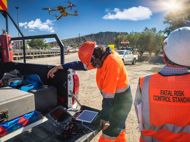
Drone inspection services are one of the most popular and useful applications of the technology. They provide a safe, efficient, and cost-effective way to inspect hard-to-reach areas, reducing the need for scaffolding or cherry pickers. Here are some examples of how inspection services are used in different industries:
-
Infrastructure: Drones can inspect bridges, buildings, and other infrastructure, providing high-resolution images and videos of the structures. Doing so allows engineers to identify damage or deterioration and plan maintenance or repairs without waiting for the exercise to be done safely when people and costly equipment are involved.
-
Energy: Drones are used to inspect power lines, wind turbines, and solar panels, allowing companies to identify faults or damage quickly, which helps prevent downtime and improve the efficiency of energy production.
-
Insurance: Drones are used to assess damage to property after natural disasters, such as hurricanes and wildfires. They can provide accurate and detailed information about the extent of the damage, enabling insurers to process claims more quickly.
Benefits compared to traditional methods:
Using drones for inspection services offers several advantages over traditional methods, including:
-
Safety: Drones eliminate the need for workers to climb ladders, scaffolding, or other high structures, reducing the risk of injury.
-
Efficiency: Drones can cover large areas quickly, reducing the time and cost of inspections. They can also capture high-resolution images and videos, providing more detailed and accurate information.
-
Cost-effectiveness: Drones are less expensive than traditional methods, such as cherry pickers or helicopters, and require fewer people.
Types of sensors and equipment used:
Drones for inspection services are typically equipped with high-resolution cameras, thermal imaging cameras, LiDAR sensors, and other specialized equipment. These sensors and equipment allow drones to capture detailed images and data that can be used for analysis and inspection. Some drones are also equipped with artificial intelligence and machine learning algorithms, allowing them to detect and identify defects automatically.
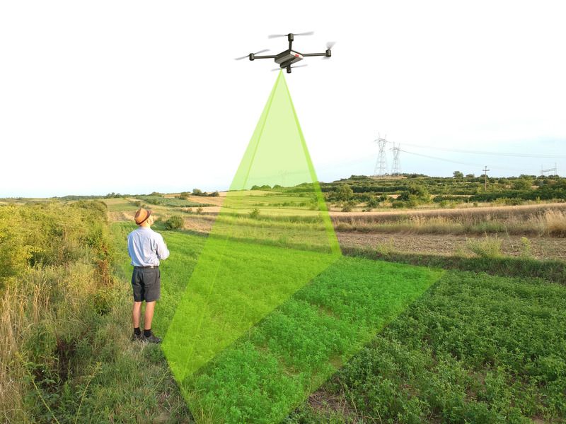
Agriculture
Drones have proven to be a game changer in various industries, including agriculture. With the ability to cover large land areas and capture high-resolution images, drones are becoming increasingly popular in precision farming, crop monitoring, and management. Precision farming involves using drones to collect data and create detailed maps of fields. This information can then be used to optimize irrigation, fertilization, and pest management, resulting in higher crop yields and reduced farmer costs. Drones equipped with multispectral or hyperspectral sensors can capture data beyond what the human eye can see, allowing for detailed analysis of plant health and soil moisture.
Crop monitoring is another area where drones are making a significant impact. Drones can quickly and efficiently survey crops, identifying problem areas and providing farmers with real-time information about crop health, enabling farmers to address issues before they become more serious, resulting in better yields and higher-quality crops. Drone technology is also being used for crop management. With the ability to apply pesticides, herbicides, and fertilizers precisely where needed, drones can reduce the chemicals used and minimize the environmental impact.
The types of sensors and software used in agricultural drone services depend on the specific application. Multispectral and hyperspectral sensors are commonly used for precision farming and crop monitoring, while lidar sensors can create detailed 3D terrain maps. Software tools such as GIS and machine learning algorithms are used to analyze the data captured by drones, providing farmers with actionable insights.
The benefits of agricultural drone services are numerous. Farmers can optimize crop yields, reduce costs, and improve the quality of their crops. Drones also enable farmers to monitor crops in real-time, allowing them to take action quickly to address any issues, providing them with the information they need to make informed decisions and improve their operations.
Environmental Monitoring
Environmental monitoring is one of the most promising applications of drone technology, with drones conducting environmental monitoring more efficiently, accurately, and cost-effectively than traditional methods in various industries, including conservation, mining, and forestry. Using specialized equipment, including optical, thermal, LiDAR, and gas sensors, drones can monitor wildlife populations, detect illegal poaching, monitor ecosystem changes, and the health of forests in the conservation & forestry industry, while in mining, drones can monitor tailings ponds, waste dumps, and other environmentally hazardous areas for signs of contamination.
The benefits of using drones for environmental monitoring are numerous. Drones can quickly and efficiently cover large areas, making monitoring remote or inaccessible areas possible. Furthermore, the data collected by drones can be processed in real-time, allowing for timely interventions in environmental emergencies.
Benefits of Drone Services
Cost-Effective & Time Efficient
Using drone services can be incredibly cost-effective for gathering information and completing tasks that would otherwise require significant time and money. This is especially true in areas such as Infrastructure Inspections where, according to a report by PwC, drones can reduce the associated costs by as much as 50%. And precision agriculture, where drones equipped with cameras and sensors can quickly gather data on crop health and yield, reducing the need for manual labor and improving decision-making, resulting in, according to a study by the University of Illinois, increased crop yields by up to 9%!
In addition to cost savings, drones are also incredibly time-saving. In heavily time-sensitive industries such as construction and surveying, a study by the University of Toronto found that drones used for creating 3D models, tracking construction progress, and surveying large land areas for creating high-resolution maps, can save up to 90% of the time traditionally required if done manually. When compounded over the entire project lifecycle, this saving quickly becomes monumental.
Safety
By far, the most impactful benefit of using drones where traditionally manpower was required is keeping workers safe and ensuring the general public's safety. In inspections, for example, drones can safely inspect infrastructure and buildings from the air, reducing the need for workers to climb to dangerous heights or enter hazardous areas. In the energy industry, drones can inspect pipelines and other equipment, reducing the need for workers to enter potentially dangerous areas, such as the inside of massive (and potentially toxic) oil tanks. According to a study by the Oil and Gas Innovation Centre, using drones for pipeline inspections can reduce the risk of injury by up to 90%.
Accessibility
Lastly, drones have vastly improved the level and depth of data collection companies can gather from their assets. Power companies, for example, need to ensure that their transmission infrastructure spread over hundreds & thousands of miles is in proper working condition. This would typically require a large crew working offsite for weeks and months and costly equipment such as helicopters and more. With drones, a small team can quickly and easily inspect and monitor infrastructure in remote or hard-to-access areas in much greater detail, improving access to information and reducing the need for manual inspections.
It is a similar story in the agriculture sector as well. Farmers with thousands of acres of farmland to survey would typically rely on a team of people using a combination of land and air vehicles to cover the entire property, whereas, with drones, a small team can just as quickly get more detailed data faster and more affordably.
Applications of Drone Services
Real Estate Drone Photography
Drone services are revolutionizing the real estate industry by providing aerial photography and videography solutions, offering a new property perspective. With drones, real estate agents can capture stunning aerial shots of homes, commercial buildings, and land, giving potential buyers a clear and detailed view of the property. These visuals can also be used for virtual tours, creating an immersive experience for potential buyers who cannot visit the property physically. In addition, drones can assist in inspecting hard-to-reach areas, such as roofs and building facades, ensuring that properties are well-maintained and safe.
Construction Site Monitoring
Drones offer numerous benefits to the construction industry with their ability to capture aerial data and images quickly and easily. Drones can help construction professionals improve project planning and management, increase efficiency, and reduce costs through aerial site inspections, monitoring progress, and identifying potential safety hazards. With their high-resolution cameras and thermal imaging capabilities, drones can help construction companies identify defects or issues in a building's structure, ultimately leading to safer and more secure construction projects.
Oil & Gas and Energy Inspections
One of the biggest beneficiaries of drone technology has been the energy sector, as companies can quickly and safely inspect remote and difficult-to-access areas of pipelines, power plants, offshore platforms, and other large infrastructure Drones can also be equipped with advanced sensors and cameras to capture high-resolution images and data for asset monitoring, pipeline integrity assessments, and environmental monitoring, acting as the first defense against potential ecological catastrophes. Additionally, drones can reduce inspection times and costs, minimize downtime and disruption of operations, and improve worker safety by eliminating the need for human inspection in hazardous areas.
Insurance Photography
One of the key tasks of the insurance sector is providing faster, more efficient, and cost-effective damage assessments & claims management. By using drones, companies can capture high-resolution images and videos of damaged properties, allowing insurance adjusters to inspect the site remotely and accurately estimate the cost of repairs. With drones, insurance companies can assess claims in a fraction of the time, reducing the workload for adjusters and minimizing the time it takes for policyholders to receive payouts. Additionally, drones can be used to monitor and assess risk, helping insurance companies to identify potential hazards and mitigate future losses.
Local Government & City Council Assistance
Drone services offer numerous advantages to local governments and cities, primarily providing real-time data and high-resolution images that allow authorities to make informed decisions, identify potential problems before they become significant issues, and respond more effectively to emergencies, along with more routine city management tasks such as monitoring traffic, land surveys, inspecting critical city infrastructure, and so on. With their ability to cover large areas quickly and at a relatively low cost, drones are an increasingly popular tool for local governments and cities looking to improve their operations and enhance public safety.
Precision Agriculture
Just as the agriculture industry was revolutionized by modern farm machinery and technology, so too are farmers today with drones providing farmers with precise and up-to-date information about their crops. With drones, farmers can capture high-resolution aerial imagery of their fields, which can be used to identify problem areas, monitor crop growth, track crop health, and make informed decisions about crop management, including the precise application of fertilizers, pesticides, and herbicides. By using drone services for precision agriculture, farmers can maximize their yields, reduce costs, and minimize environmental impacts, ultimately leading to a more sustainable and profitable farming operation.
Marketing and Advertising
Drones have been a game-changer for the advertising and marketing industry by providing companies with a unique and dynamic way to showcase their products or services. Capable of capturing stunning aerial footage & photography that can be used for promotional videos, commercials, and social media, drones provide panoramic views that would otherwise be impossible to obtain, allowing companies to showcase their products or services in a more visually engaging way. Additionally, drones in advertising and marketing can help companies stand out from their competitors, create a lasting impression on their target audience, and ultimately drive more sales.
Regulations and Safety Measures for Drone Services
As the use of drones continues to grow in popularity for commercial and industrial applications, businesses need to understand the regulations and safety measures in place to ensure safe and responsible drone operations. This section will provide an overview of the rules set by the Federal Aviation Administration (FAA) and state and local authorities, as well as safety guidelines for drone pilots and operators.
Federal Aviation Administration (FAA) Regulations
The FAA has established rules and regulations for commercial drone operations in the United States. These regulations cover various requirements, from pilot certification to airspace authorization. To legally operate a drone for commercial purposes, the drone pilot must obtain a Remote Pilot Certificate from the FAA, demonstrating that the pilot understands the regulations and safety guidelines for drone operations.
Additionally, all drones used for commercial purposes must be registered with the FAA and display a unique registration number on the aircraft. Airspace authorization is another important consideration for commercial drone operations. The FAA has established rules restricting drone flights in certain areas, such as near airports or other sensitive locations. Pilots must obtain permission from the FAA or use an approved automated system to access these restricted areas. The FAA regularly updates its regulations and commercial drone operation guidelines, so businesses must stay informed about the latest developments.
State and Local Regulations
In addition to federal regulations, businesses must also comply with state and local rules for drone operations. These regulations can vary widely across jurisdictions and industries. For example, some states have established their own certification requirements for drone pilots, while others have enacted rules governing the use of drones for specific purposes, such as land surveying or agricultural inspections. Local authorities may also have regulations and permitting requirements for drone operations within their jurisdictions. Compliance with state and local regulations is important for businesses operating drones in multiple locations or industries.
Drone Safety Guidelines
Safety is a top priority for drone operations, and pilots and operators should follow several guidelines and best practices to ensure safe and responsible flights.
Some essential safety tips include:
-
Always keep the drone within sight.
-
Avoid flying near people or animals.
-
Check the weather conditions before flying.
-
Conduct a pre-flight check of the drone and equipment.
-
Maintain a safe distance from other aircraft and obstacles.
-
Follow any applicable airspace restrictions or guidelines.
Many resources are also available to help drone pilots and operators improve their skills and knowledge of safety guidelines. Training courses and educational materials can provide valuable information and practice for safe and effective drone operations.
Choosing the Right Drone Service Provider
When hiring a drone company, choosing a company that can meet your specific needs and delivers high-quality results is essential. Here are some key factors to consider when choosing the right drone service provider:
Reputation
The reputation of a drone service provider is a critical factor to consider. Look for a company with a record of delivering high-quality work and excellent customer service. You can check online reviews and ratings to get a sense of a company's reputation. It's also a good idea to ask for references or examples of previous work to assess the quality of the provider's output.
Experience
Experience is another key factor to consider when choosing a drone service provider. You want to work with a company that deeply understands your industry and specific needs. Look for a provider with a proven track record of successfully completing similar projects, with the necessary licenses, certifications, and insurance to operate drones legally and safely.
Equipment
The quality and capability of a provider's equipment are crucial in determining the quality of their work, so make sure your chosen provider has the right equipment for your specific needs. Ideally, look for a provider with drones equipped with high-quality cameras, gimbal stabilization, the ability to capture high-resolution photos and videos, and advanced data processing and analysis software.
Customer Service
Arguably one of the most important considerations, a provider's level of customer service is an important factor worth considering. Look for a provider that is responsive and easy to work with and is willing to answer your questions, provide updates on your project, and be flexible in accommodating your needs.
Future of Drone Services Advancements in technology
Advancements in Technology & New Applications
The drone industry is constantly evolving, and technological advancements drive innovation in the sector. One of the most significant advancements is the development of autonomous drones, which can navigate and perform tasks without human intervention. This technology is expected to revolutionize drone services, making them more efficient and cost-effective. Another notable advancement is the integration of artificial intelligence (AI) and machine learning (ML) algorithms in drone technology, enabling drones to process vast amounts of data, make decisions, and perform complex tasks.
As drone technology advances, there are endless possibilities for new applications. One of the most promising areas is using drones for delivery services. Companies like Amazon, UPS, and Google are already experimenting with drone delivery, and it's expected to become a mainstream service in the future.
Potential Challenges
While the future of drone services looks promising, potential challenges need to be addressed. One of the biggest challenges is the need for regulations and policies to govern the use of drones. As drone technology advances, there is a risk of privacy violations and safety concerns. Governments must create policies that balance innovation and safety while protecting individual rights. Another challenge is the need for skilled drone pilots and technicians. As the demand for drone services grows, there will be a need for trained professionals who can operate and maintain the technology. Companies and educational institutions must invest in training programs to ensure a skilled workforce to meet the demand. Overall, the future of drone services is exciting, and technological advancements will continue to drive innovation in the sector. With the right policies and investments in training and infrastructure, drones have the potential to transform industries and improve our lives.